Wrapping up AGF projects, planning for new ones.
Wrapping Up
Another productive month with a good number of the student AGF projects coming to an end. Very keen to follow the results through as far as a can. One of the challenges with working on technical projects is the tool and impact can be quite removed from each other. This distance means that there are many barriers on the way from deployment to use that could cause all efforts to be in futility. For instance, your work being forgotten or incomprehensible or having the underlying data change in a way that renders a model unusable. All of these factors necessitate constant vigilance to see the project through from inception to impact.
My first project to wrap up is one on improving wildfire prediction in Hawai’i (an interesting problem area, due to the islands’ unique vulnerabily and surprising lack of resources to deal with the problem, as most national support for wild fires – such as prediction models – are tailored for vastly different environmental conditions, and the state has limited funds to develop bespoke tools. For this, we collaborated with the Hawaii Wildfire Management Organization. We managed to build a simple model to predict, at a fine grid level, the probability of wildfire for a given month. To add something new to what has already been done, we added teleconnection indices and tourism patterns.
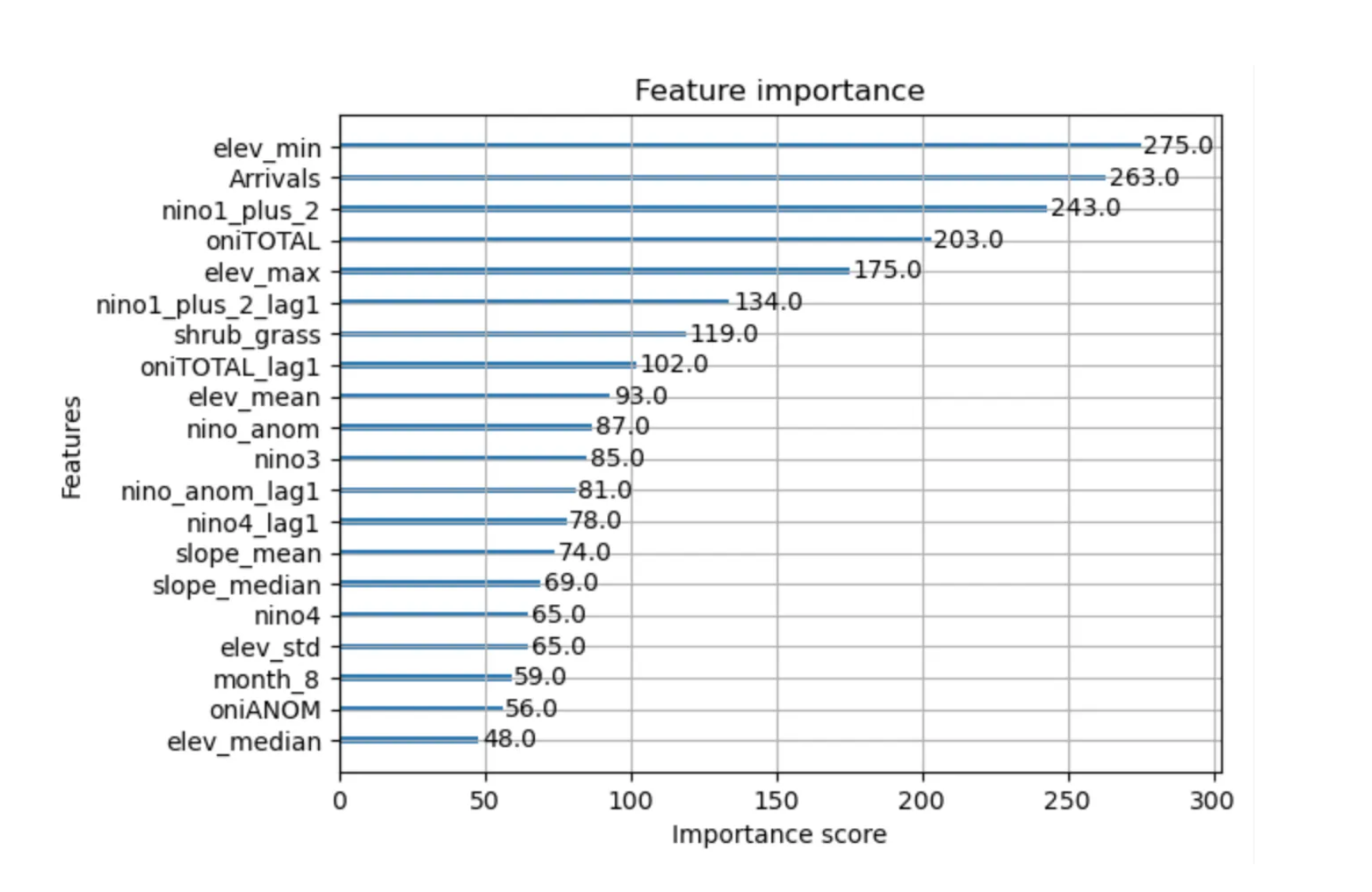 Incredibly strong performance from the teleconnection indices and monthly tourism rates (“Arrivals”) in aiding predictions, in addition to the tried-and-true predictors for elevation and vegetation.
To ensure this work sees the light of day, I’m closely working with Clay Trauernicht at the University of Hawai’i, probably the most knowledgable person in the world on Hawai’i wildfires. Specifically, I’ve proposed overlaying ignition probability maps with exposure data and directly tie this with information that would be useful for decision-makers and on-the-ground response. This would use data from OSM to identify high risk assets/communities and provide specific actionable information to decision-makers, based on information needs. For example, responders and planners might want to know:
- Does X populated place have a fuel break between high ignition probability vegetation and the community?
- Does X populated place have any hospitals or clinics in high ignition probability areas?
- Does X populated place have any access roads in high ignition probability areas?
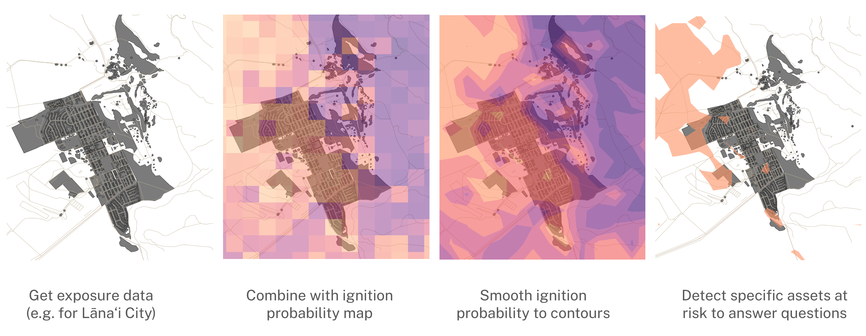 E.g. for Lāna’i City, can say there are two major residential areas connected to high probability ignition vegetation without fuel breaks: South Ohohia Street and the Lanai City Hawaiian Home Land; Lanai Community Hospital is not in a high ignition probability area; there is one major access road in a high ignition probability area: Keomuku Road.
Fun With LLMs and Web Scraping
A large number of the projects run this cycle involved integrating LLMs and web scraping. This is an (in my opinion) relatively unexplored way to get a large amount of high quality data that would otherwise take human analysts an unrealistically large amount of time to obtain. For instance, we are working on one project with ACLED (Armed Conflict Location & Event Data) to improve their Conflict Alert System. To do this, we are adding additional data from web scraping news sources (specifically looking for contested elections, crop failures, economic concerns, military coups, political assassinations, natural disasters, and ethnic tensions). We also add some pre-existing curated datasets for economic factors and religious festivals.
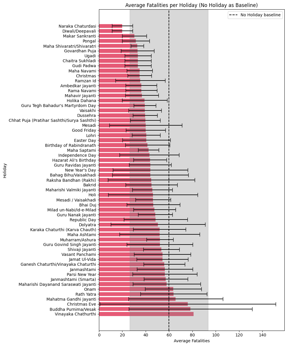 Basically, festivals that get more people out on the streets have a higher association with violence than those that sequester people away in their homes.
Another one is further developing LexiMine, a LLM/web scraping tool designed to make it easier to scrape data targets from historic web text. In the past, we’ve used this to get data on antimicrobial resistance in India, now we’re using it to perform jurisdictional scans (i.e. compare policies in different regions), specifically for comparing different antimicrobial pharmaceutical approval policies in ASEAN countries. The fragmented regulatory landscape in this region makes it very difficult for new pharmaceuticals to be approved, increasing the risk of antimicrobial resistance in these already vulnerable countries.
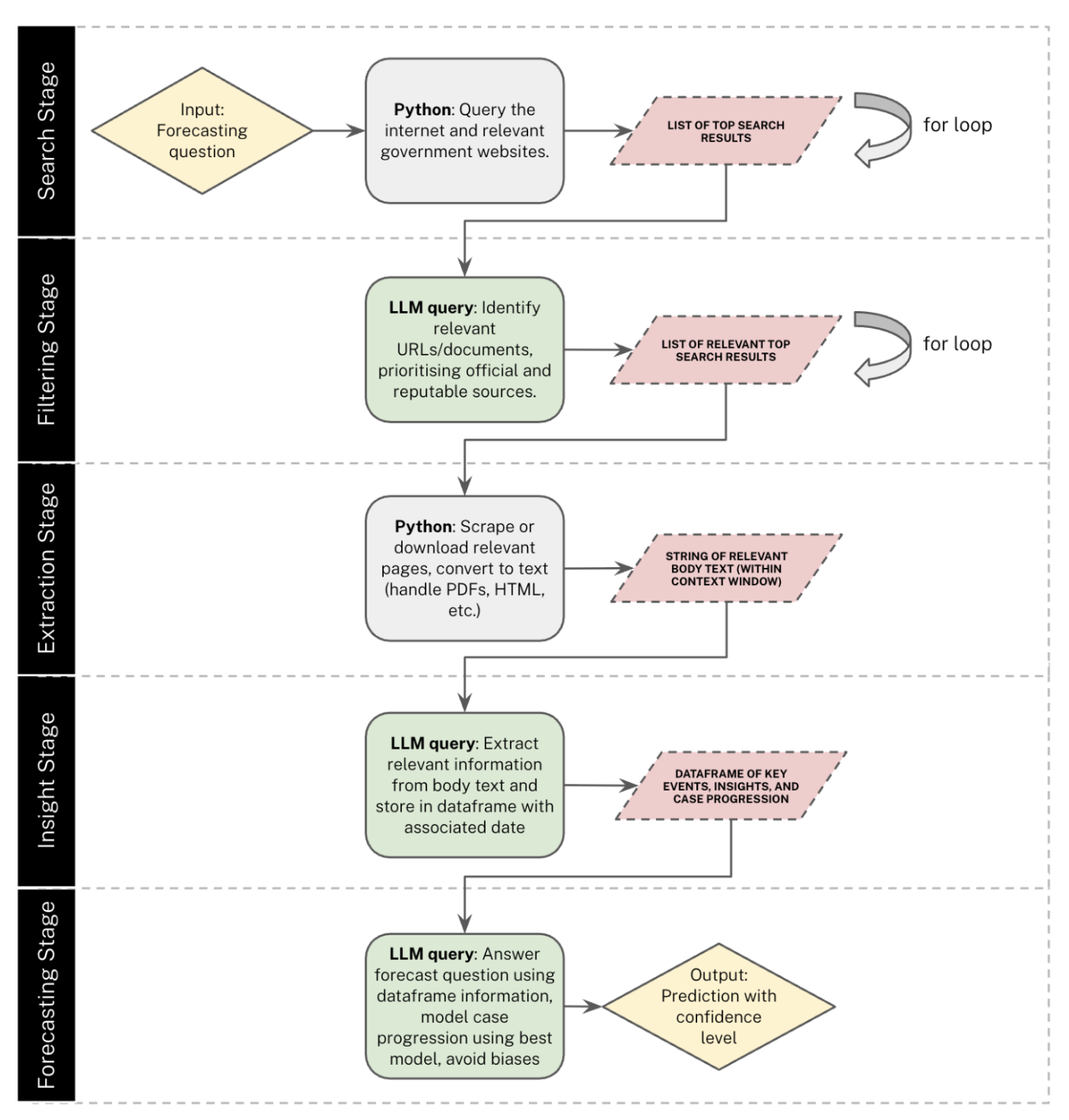
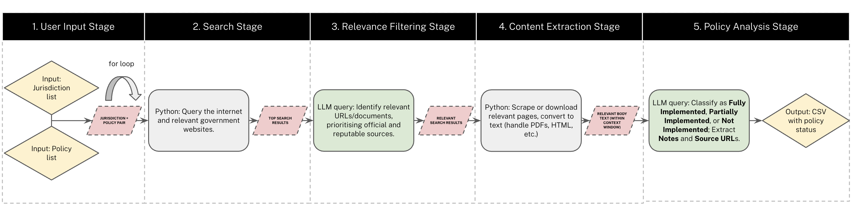 Model structure for LexiMine, as it’s being used for doing jurisdictional scans.
Planning New
We want to take the applications of LLMs/web scraping for biosecurity one step further, by evaluating how well they can perform in making biosecurity predictions (based on web scraped and LLM-processed text data for news, academic research, and public health reports) when compared to aggregate expert predictions.
 Proposal for BioScanCast, which would convert web scraped public health information into live predictions of outbreaks and epidemics.
Currently in the process of applying for a grant to fund this work with the Oxford Biosecurity Forecasting Group, will update in a month or so.
Also currently working on a model for the Fish Welfare Initiative to predict Andhra Pradesh aquaculture pond quality using exclusively remote sensing – more details on this next month.
Living Life
Fairly active weekends this month as I try to capture as much of the end of summer as possible. Alec and I made two separate trips to the Cotswolds: one romantic hike which I hijacked into a trip to Crocodiles of the World (sorry Alec), and one hike with a friend visiting from Toronto.
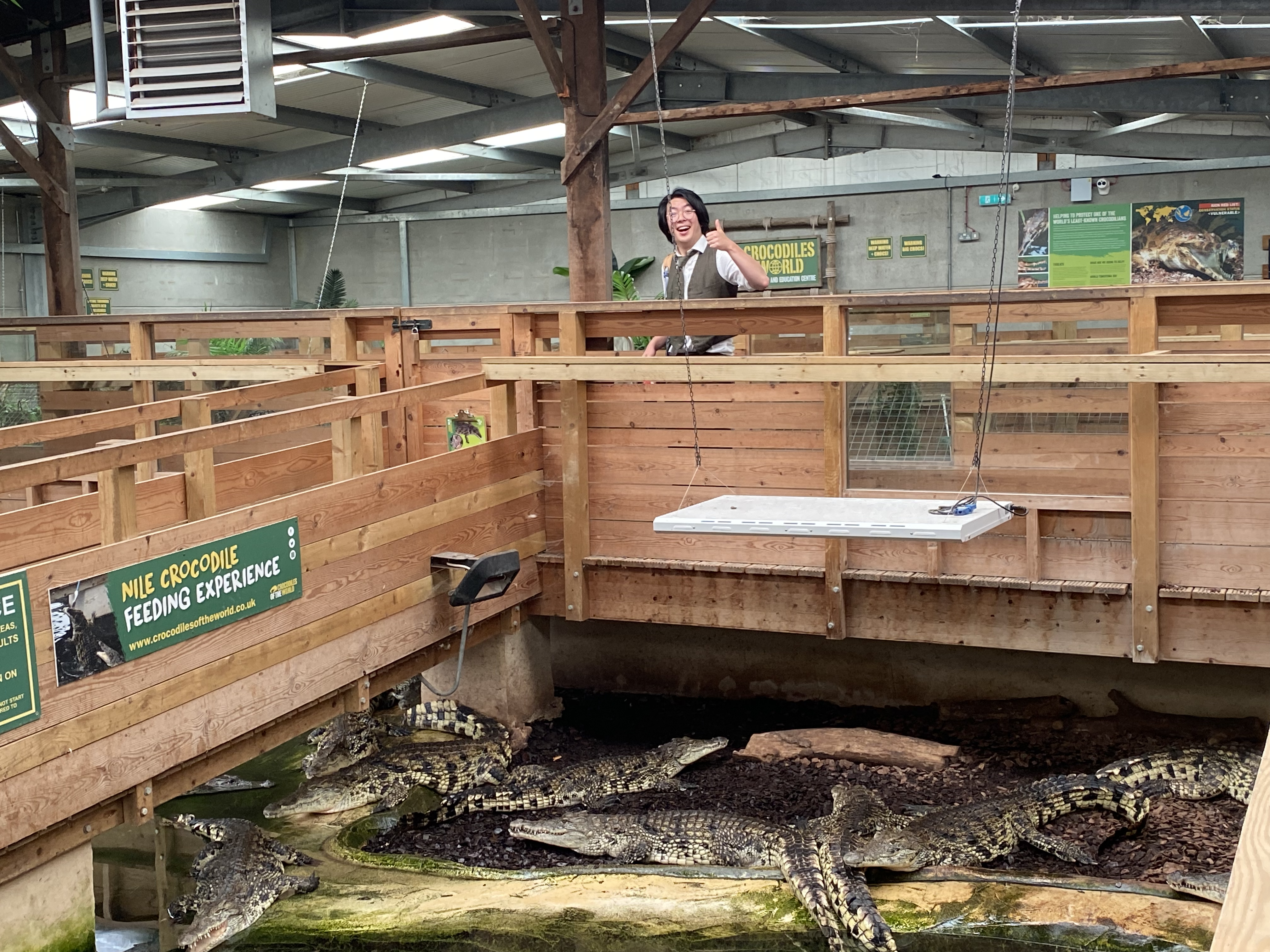 They were certainly “of the world”.
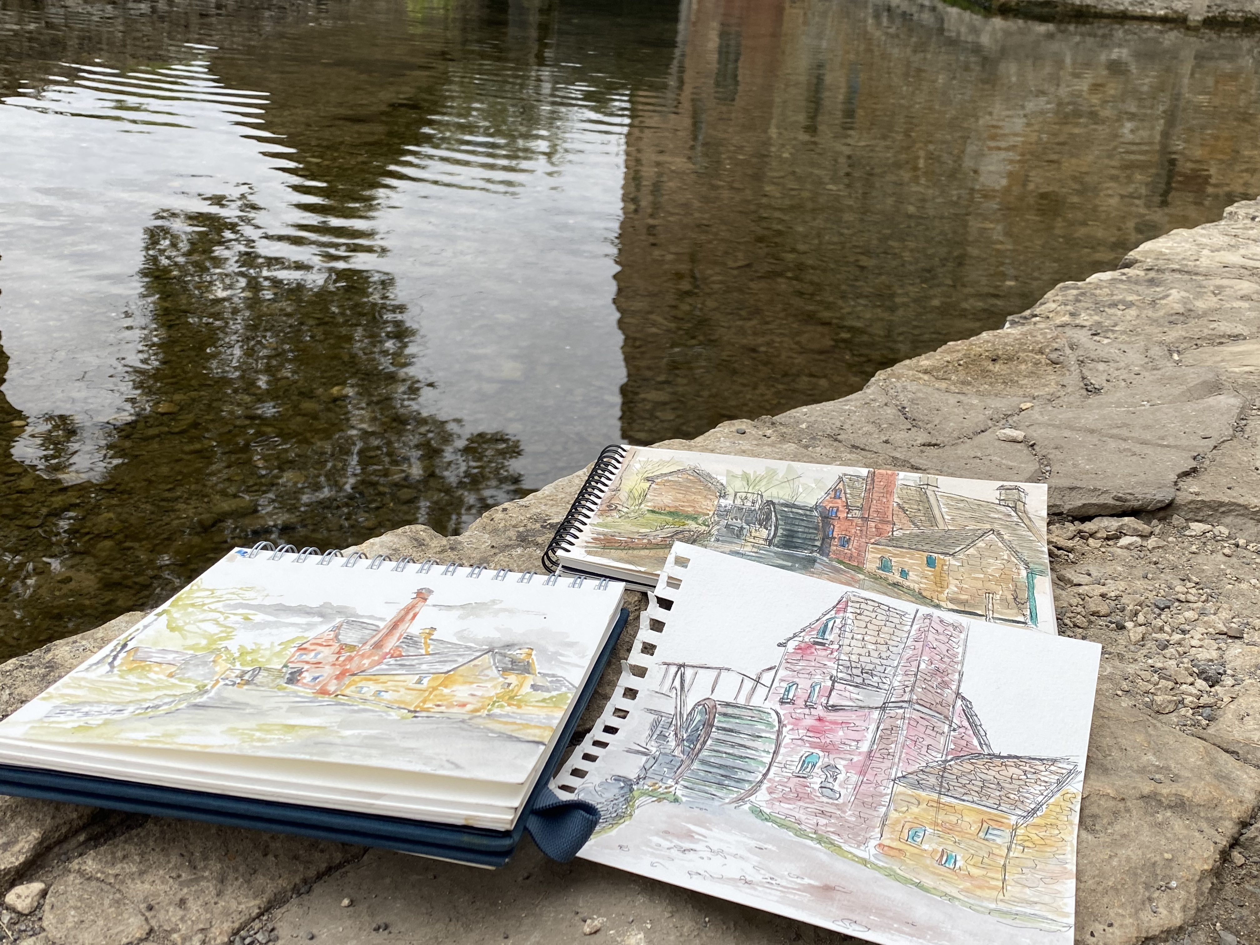 Our three paintings of a Cotswolds scene, though my Toronto friend hogged the watercolours.
We went to a Chappell Roan x Hozier concert at Reading Festival (my first major concert) and drove out to Coniston for a weekend wild camp in the Lake District (Holme Fell).
Highlight was definitely watching the unenthused man in front of us perplexedly Googling “is chapel[sic] roan lgbt” after the first number.
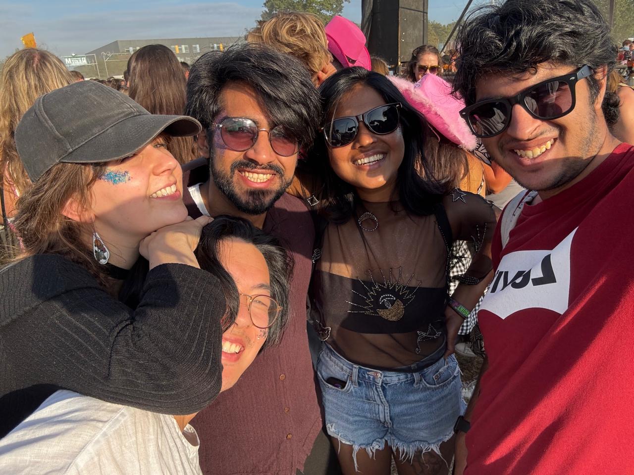 Festival.
We admittedly were rained on quite heavily during our camping trip, but it was fun nonetheless.
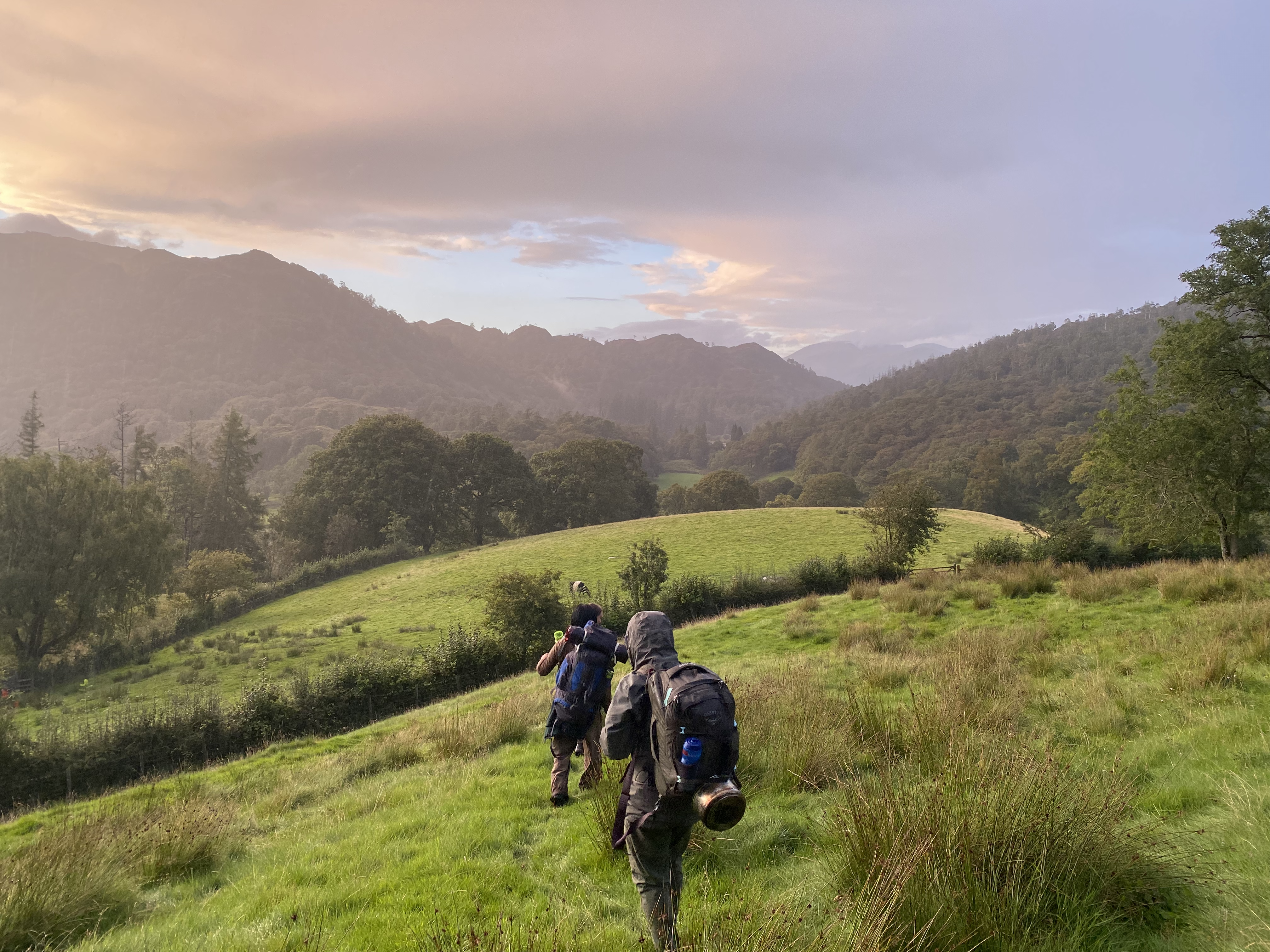 We arrived at Coniston much later than intended, resulting in a frantic dusk scramble up the mountains in near-darkness to reach our intended camp site before night completely fell.
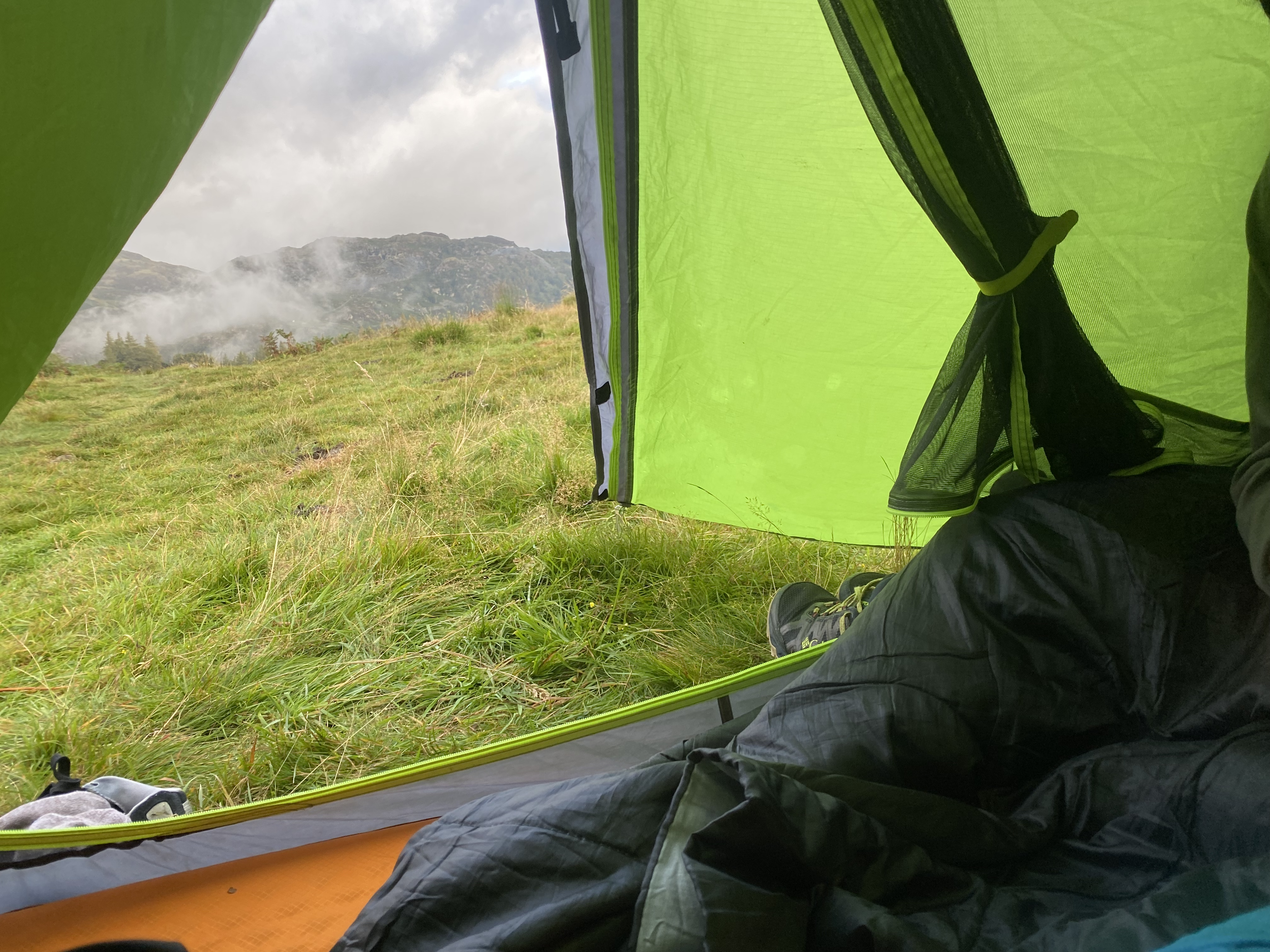 View from the top our campsite at the top of the mountain (wild camping is technically illegal in England, so you have to set up your tent far out of sight at sunset and take it down at sunrise, lest the National Trust rangers come and yell at you).
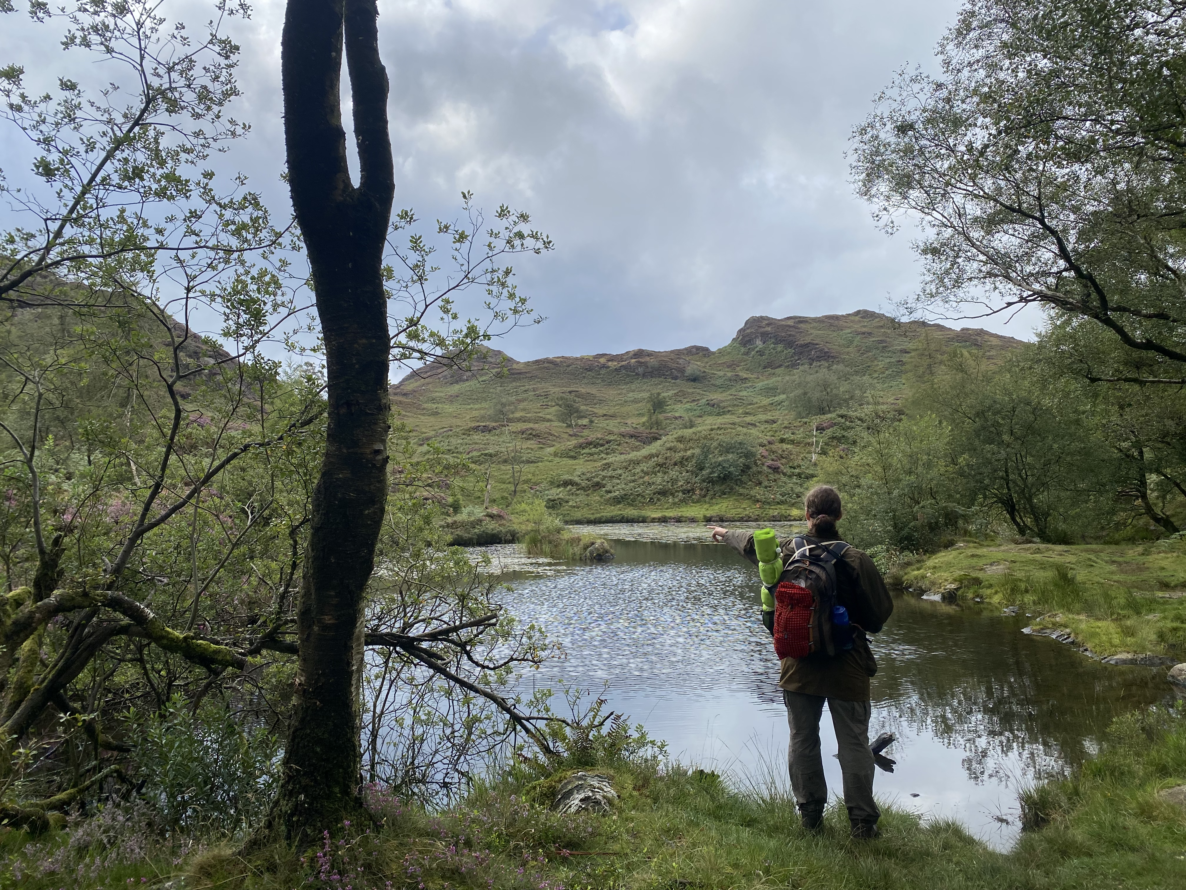 Our second camp sight, over Holme Tarn.
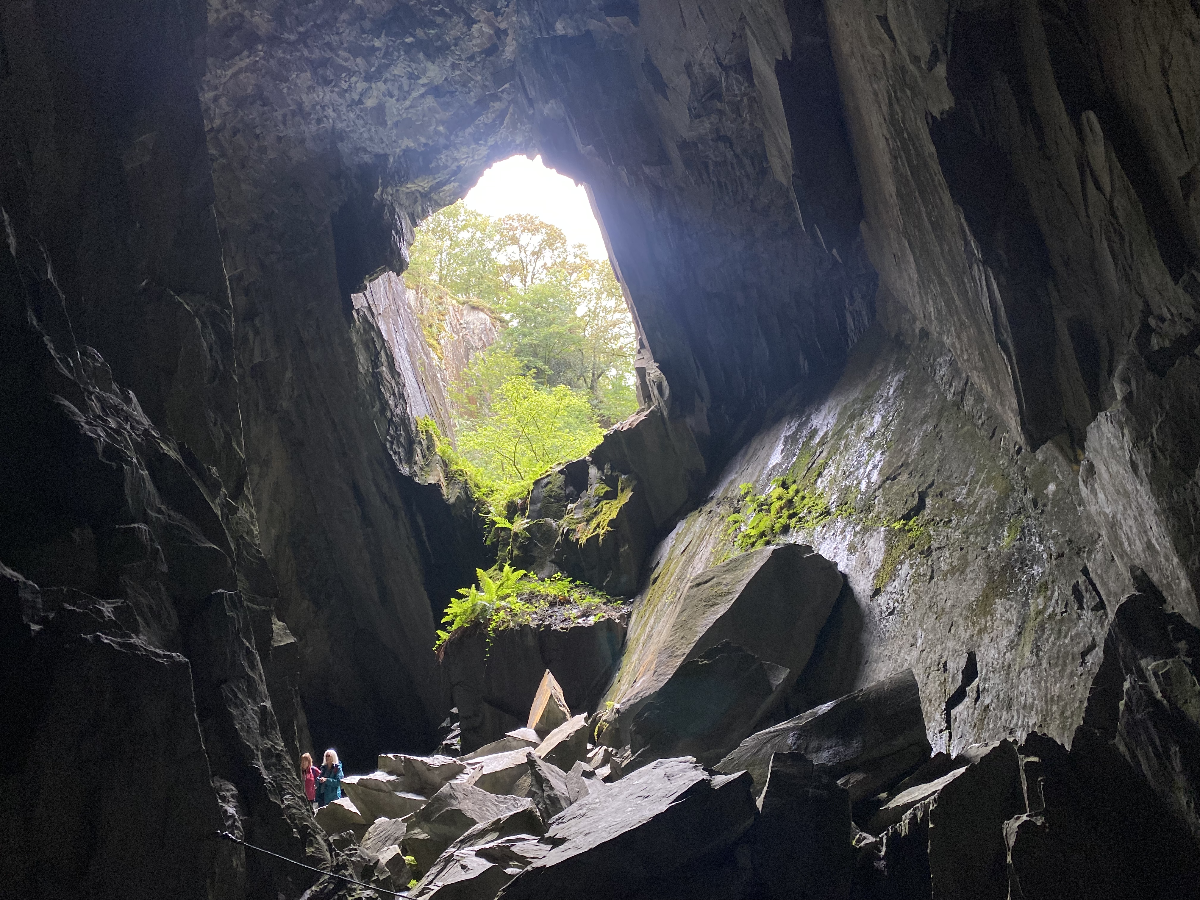
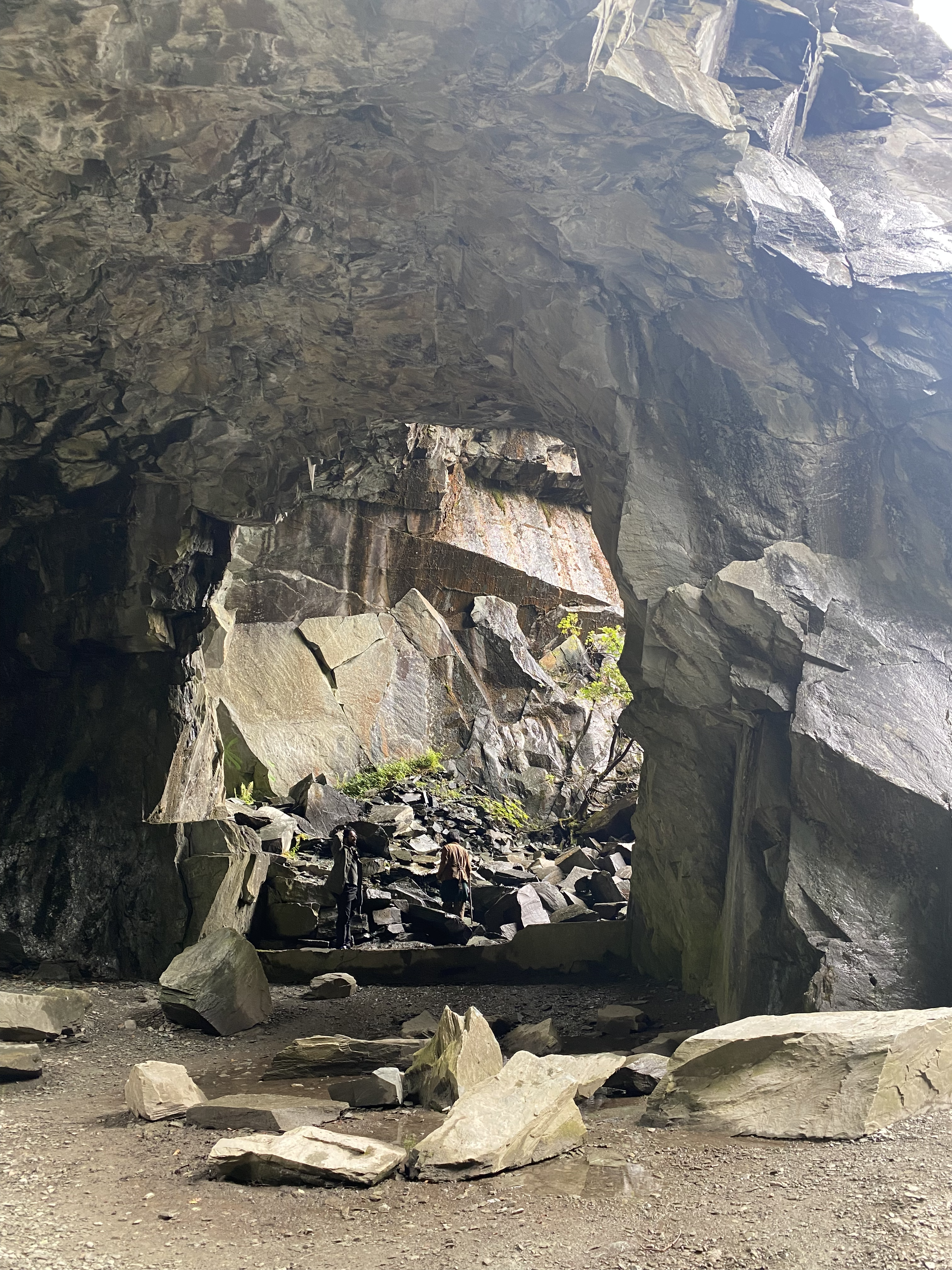 Neat abandoned quarry we found and swam in.
 Had no idea English nature could be this beautiful and *wild.*